
Hiking the Appalachian Trail is on many people’s wish lists – you might hope to hike from Springer to Damascus or complete the whole 2,190 miles of trail. It doesn’t matter what you do, the important part is to have at least one reliable Appalachian Trail app as a companion.
Today, I am here to share the best of the best: they offer a variety of features, from maps to real-time weather updates and alerts, and a lot more in between to ensure that your hike is as safe as possible.
You Shouldn’t Hike the Appalachian Trail without an App!
An app is essential today to ensure that you reduce risks to a minimum. While you should always have a paper map for increased safety (in case your phone’s battery runs out, for example), apps offer plenty of added benefits.
For instance, when you’re on a long stretch of trail and can’t easily pinpoint a landmark, an app using GPS will immediately show your location and guide you to the nearest water source or shelter.
Some apps also give you real-time updates from other users so if there is a new permit required or water is running low in summertime, you’ll be the first to know.
Best Apps for the Appalachian Trail
With these in mind, let’s jump right into today’s recommendations for the apps you should always have on your phone if you’re planning this adventure. I recommend having more than one just in case – although for most people, any single app listed below should be enough.
FarOut
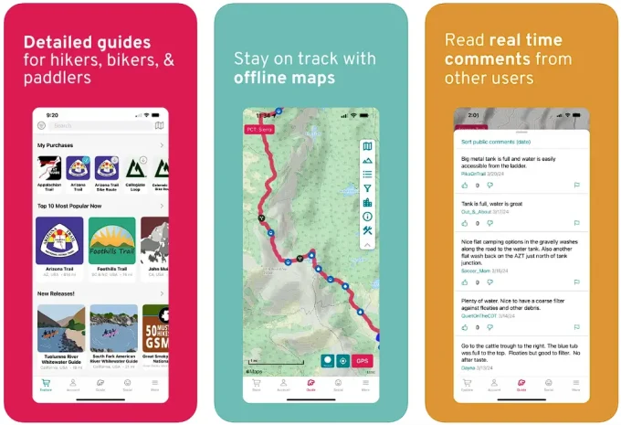
This is the official app for the Appalachian Trail, offering hikers direct access to updated trail conditions, official waypoints, shelter information, water, junctions, campsites, and community news from the Appalachian Trail Conservancy.
With offline map capabilities and real-time updates, FarOut is the first app you should install on your device if you’re planning a journey along the trail.
Available on: App Store | Google Play
Also read: How to Keep Food Warm During Hiking
Gaia GPS: Mobile Trail Maps

This is considered the best collection of offline topo and satellite maps available. Whilst not specific to the Appalachian Trail, you can plan a route ahead of time and view detailed satellite imagery. You can sync your tracks, photos, maps, and waypoints to all your devices as well as share links via Facebook, X, SMS, and more.
You can link photos to a waypoint so you never forget the location of that special memory. It’s also possible to access information such as pace, distance and elevation and, of course, access offline maps. There are some features that you need to have a membership subscription for in order to access, but it’s worth it.
Available on: App Store | Google Play
AllTrails

A solid alternative to Gaia GPS recommended above, this is a highly popular app for hikers, providing detailed maps, user reviews, filters by trail difficulty and/or length, and offline access.
It’s a versatile tool that covers many trails, including sections of the Appalachian Trail, and is great for planning both short hikes and longer journeys.
Available on: App Store | Google Play
Also read: Should you go hiking in jeans?
Hiking Project

This free app offers interactive maps, in-depth trail data, ratings and rankings, photos, custom trails, and offline functionality.
It’s crowd-sourced and frequently updated, making it a solid resource for current trail conditions, user tips, and detailed route planning for your Appalachian Trail adventure.
Available on: App Store | Google Play
Komoot

Last but not least, we have this app that’s known for its excellent route planning and navigation features, making it the perfect option for your next adventure.
Komoot delivers offline maps, clear elevation profiles, turn-by-turn voice navigation, plus plenty of other features. It’s ideal for hikers who want an all-in-one solution for planning routes and managing navigation while on the trail.
Available on: App Store | Google Play
Key Features to Look For in Your Chosen App

All the recommended apps above tick all (or at least most) of the boxes below, but you should always make sure that the app you’re installing on your device has as many helpful features as possible. Here’s what I always look for – and recommend you do the same.
Topographical Maps: These maps offer detailed views of the trail with clear markers for elevation and natural landmarks. An app that syncs GPS data with a topo map makes it easier to stay oriented.
Elevation Profiles: When planning a hike, knowing the upcoming climbs and descents helps you manage your energy (or maybe even choose alternative routes if it’s too difficult).
Water Sources: Information on water availability and source reliability can prevent unexpected shortages. An app that marks water sources with notes on seasonal reliability is a must, especially for longer trails where you might run out of water.
Speaking of water, make sure to check out the best water purification tablets here.
Shelters and Campgrounds: With hundreds of shelters and designated campsites along the trail, knowing the distances between these spots is important when planning your next adventure, especially if you need some extra rest.
Road Crossings and Resupply Points: It is important to know where you can catch a ride or stock up on supplies. An app that shows nearby towns, resupply points (including the shelters and campgrounds mentioned above), and road crossings helps in better planning for your journey.
Weather Updates: Real time weather information and predictions can mean the difference between a safe hike and an emergency. Some apps offer localized forecasts that adjust as you move along the trail, and those are the best to have.
Offline Functionality: Since phone service is not guaranteed on the trail, I prefer apps that work offline, allowing me to access essential information even when I’m far from any network. Even so, consider carrying a portable charger (check out our recommended solar portable chargers here). Reducing screen brightness and closing unused apps can help conserve power.
I also like to check if the app includes a feature that lets users leave notes or updates. A shared “Trail Register” can be a lifeline for unexpected trail changes, as experienced hikers update one another about water levels, new permit requirements or any type of important information one should know.
If we’ve missed your favorite app off the list, let us know in the comments section below.

Daniel is a gear freak when it comes to hiking, climbing and camping. He went to REI Outdoor School to meet new people and learn best practices. Don’t even try to argue with him about the latest backpack or ice axe, he tried most of them. Daniel’s dream is to climb Mount Everest.
Appalachian Trail apps are a wonderful way to enhance the time you spend on the trail. If you are willing to put in the time before hand you can find the series of apps that will work best for you. Each app will typically have a goal of giving you every piece of information you need about a particular thing. It can seem cumbersome to switch between apps, and perhaps it is, but by allow several separate things to have their own expertise you end up getting a lot more quality, up to date information.
The Guthook’s Guide is highly recommended so if you plan to try the Appalachian Trail, make sure you have this. The phone’s GPS is used by this app and it guides you to more than 3500 waypoints. It is also equipped with elevation profiles and a trail register that’s interactive. Cool, right?
Personally, I love GAIA GPS and I have used it for months now. Their maps and trails are really impressive in quality. The features and its capabilities are awesome too. It’s cool that it gives the user the option to get driving directions even if the GPS is offline, which I think is very important. I would really recommend it to everyone.
You are right, Liz! Thank you for your comments and giving us your own point of view. Hopefully others can take your advice!